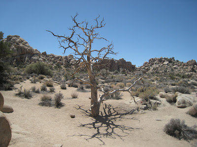
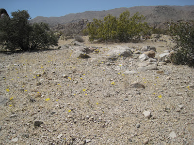
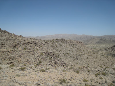
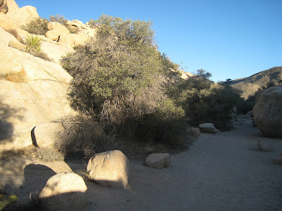
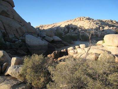
We knew we wanted a nature-themed Spring getaway. And though wed considered tulips in Netherlands, Mosquito Bay in Puerto Rico, and cherry blossoms in Japan we decided we wanted something simple. Our passports rarely lie dormant long enough to collect dust so "simple," we decided, meant "domestic."
We began and ended our search in one click. Results for "best parks to visit in spring" yielded a top ten list which included some wed been to, some we weren’t interested in, and a few that sounded just right. The rightest of the right was Joshua Tree National Park.
Now that we had our destination we needed our lodging. I was up for camping but you-know-who felt otherwise. So the hunt was on for the precise combination of rustic nature and running water. Again, we began and ended our search in one click. Results for "secluded unique fireplace "hot tub" starry sky "joshua tree"" gave us Rock Haven. I can count on one hand the number of times I have found a lodging that looked so perfect that I didn’t even look at a single other option. Admittedly I believe I took to the cabin due to its likeness with my grandmother's farm in the mountains of West Virginia. A no-frills but exceptionally homey mix of woodstoves, fringed rugs, screen doors, and afghan-strewn sofas. Endless hours spent on the patio hearing nothing but nature and the creak of that old porch swing are the very root of who I am today.
[Pause for moment of nostalgia]
Off to Joshua Tree.
Joshua Tree National Park is in Joshua Tree California which is about a 2.5 (or 5) hour drive east from LAX. Once we landed we caught a shuttle over to Fox (f-o-x) Rental Car which was the only place we found where we could reserve a 4x4 high-ground clearance vehicle (i.e. a Jeep) for under $1,000. We wanted said 4x4 high-ground clearance vehicle b/c many trails and sights in the park aren’t otherwise accessible. Since so much was riding on us ensuring we obtained such a specific, expensive, and apparently uncommon, type of vehicle we were certain someone would somehow eff something up and wed have to crack skulls (Dick Vernon). We were prepared for problems. So we were more than pleasantly surprised (actually looked at each other like “did that just happen?”) as we drove off the lot in our 4x4 high-ground clearance white jeep without ceremony.
We forgot to bring our GPS. And it’s something like $10/day to rent one with the car. We decided to risk it and put our journey in the hands of our cell phone which for whatever reason relies solely on “Bing maps” (putting in quotes because initially it was said with such disgust). Our first test: find a car charger cord (typing Target into Bing maps, expecting nothing and….it was fine). Next: swing by our 2 staples to buy provisions for the week (enter Trader Joes for him (was tempted to try the $2 TJ wine we’d heard so much about over the years), Whole Foods for her…both fine). For the record the car rental, TJ, and WF are all within a few miles of the airport in an area called Manhattan Beach-we checked into this before we left but, you know, we weren’t sure “Bing maps” was going to pull through. I’ll stop putting it in quotes now b/c it did a great job.
Almost time to hit the road but for like a week leading up to the trip we couldn’t stop talking about food we wanted to eat in CA. Specifically, Del Taco (you were expecting something fancy weren’t you) and how we *had* to go there while in LA (had been yeeeaaars ago on stopover in CA and remembered it being something I think better than it really was). Anyway, research showed us there were multiple DT in the Joshua Tree area so no need to force fit that now. Instead we went for In-N-Out Burger. And to be honest I think I’d only heard of that on thesuperficial when they show celebrities jamming huge burgers in their mouths. But we went “because it’s LA”and it actually ended up being an interesting time. I don’t eat meat so had researched beforehand and found you could get a burger without the burger. It’s called a veggie burger but really it’s just lettuce, onion, and tomato on a bun. They ask specifically if you want the onion and it’s a huge thick ring of mildness that adds a nice bitto kick. The bun was that perfect combination of toasty on the outside and soft and doughy on the inside that is almost never achieved at fast food places. The fries were good, fine, not bad tasting at all-nothing out of this world but when are they? A few things stand out about this place. 1. The ingredients are mad mad mad mad fresh 2. The workers inside ran that operation like nobody’s business-every single solitary person in their little white apron and little white hat was moving to get orders ready-like the oompa loompas running the chocolate factory 3. Sitting in the parking lot the planes arriving at LAX are right overhead and literally I mean right overhead. 4. It’s true-there are bible verses on the food containers.
Bellies full, we check the clock and hit the road. We should be there by our 4:00 predicted time of arrival. Or not. There’s this thing in LA that we’d heard about and I’m not sure if we just forgot it or just thought it wouldn’t happen to us: traffic. We sat like suckers in the right lanes because for whatever reason it took nearly an hour for us to realize there was an HOV lane. We are enforcers and loved watching Ponch and Jon ride up on their motorcycles and actually check to make sure those in the HOV lane really were HOV. Once we busted through 6 lanes of basically parked cars to enter the HOV lane things moved a little quicker-that’s how we got to JT so fast…(sarcasm).
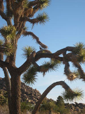
Despite the giant wind turbines, with the freaky red eye and slowly spinning arms, which have some serious alien-like qualities, the drive was really a pretty one and we both shrieked with excitement when we caught our first glimpse of the unmistakable branches of a joshua tree!
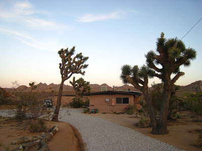
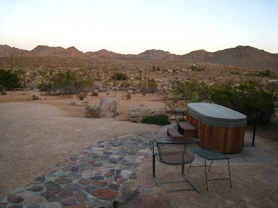
As our trusty steed motored us into higher elevation the yuccas disappeared and the joshua trees prevailed. Directions to Rock Haven cabin were clear and we had no problems locating it. We arrived at the prettiest time of day (as the setting sun casts its yellow glow across the land) and had some time to survey the property while we waited for our hosts to arrive. Our first impression: perfect! Joshua trees, giant boulders, excellent views. In addition to nice touches such as neatly folded blankets on the lounges, rock gardens, and a bird feeder, the latter of which would provide seriously endless hours of entertainment (more on that later). And what's that in the near distance? Along the base of the mountain range? Oh it's the park entrance! You are for all intents and purposes *in* the park when you stay at Rock Haven-awesome!

So I want to describe this birdfeeder now: take a 3 foot wooden pole and insert into ground. Place a bundt pan atop this pole. Voila! I loved loved loved loved this. I immediately wanted this for our house and started planning in my mind's eye where in our garden it could go until Chris reminded me of something which shattered that dream: squirrels. Oh well...
Our hosts arrived and brought us inside the cabin which was exactly as pictured online but even cuter in person. Not only was the cabin decor perfect for a week of nature and r&r but it was stocked with staples (spices, baggies, nockies, foil, guidebooks such as the best ever "On Foot in JTNP," etc.) that helped make our stay a lot like home. We easily replaced whatever we used as there are shopping options nearby. As the girls showed us around the cabin I was most excited about the fireplace in the family room and the birdseed container under the sink! The fireplace because I imagined cool desert nights cuddled up next to the fire...hmm should we do that before or after the hottub under the stars!? And the birdseed because I love animals.
That first night, after setting up house, we of course went to Del Taco and put some serious thought into "what's better, this or Taco Bell?" Verdict: DT nacho chips are def better.
The good thing about this trip, I said that night, is that we are here for 7 nights. We have no itinerary. No pressure to cram things into 3 days. We can just go at our own pace (more on that later).
So the next day we started out at the visitor's center which is a place we don't often find ourselves. I liken it to reading directions-we prefer to just jump in. But since we had alllll this tiiiiime, why not!? Surprisingly, we made it without our jeep blowing off the road-there was some serious wind going on. The center was somewhat interesting. They had a video playing that gave some background of the area and the park. Oddly, none of the visitors in the center looked like they actually intended to go *in* the park. Like, not dressed for hikes....
Anyway, next up, thanks to Anthony Bourdain, we then took a short drive to Pioneertown to check things out and have lunch at Pappy and Harriet's. What can I say about Pioneertown and Pappy and Harriet's....skip it. It wasn't bad but in retrospect we could've done something far better with our time that day. The "town" is a short block of saloon-ish/western buildings used as movie sets way back when. And I actually think we saw/read/heard people actually live, like for real live, on that block. So it was a weird mix of old and new and real and fake? There were random people dressed up like Little House on the Prairie but just standing around. Were they entertainers or simply dressing up for their own enjoyment? We couldn't figure it out. It took about a second to walk down the block because we decided it just wasn't our bag. We weren't super hungry really but what else to do but head into P&H.
In we go, carefully jockeying our way around the crowd of motorcycles parked outside. The decor inside was what one might expect. Actually I can't say that. I'm not sure what one might expect. But it had signs, pictures, and animal heads adorning its walls. Which is fine. The service was fine-not bad. My food was fine-nothing special. Chris had a steak quesadilla which he says was a little fatty but had really nice mequite smoke flavoring hes never had before. One thing that made us laugh as I looked around at the other patrons is that you could instantly tell who was local and who was not. It wasn't in a bad way, it just was. I think if I lived in that area I could totally see this being the local hangout-partly b/c there arent a lot of alternatives but also because it certainly seemed like it could have a chill vibe to it which I can appreciate. We had researched and known Franz Ferdinand would be playing there later that week but opted out; crowds weren't on the agenda this time around.
Anthony Bourdain also went to the Integratron...we did not.
We headed back to the park for some self-guided nature walks. The park has a handful of these which are usually short loops of easy terrain that offer interesting and informative signs along the way. It's a nice activity if you don't want to/don't have the time to take on some of the more involved hikes. It's also a relaxing bonus at the end of a day of legit trekking-you can just chill, follow the clearly marked path, and lose yourself in the surroundings without losing yourself in the park-keep reading, you'll see.
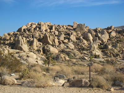
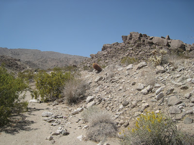
We started with a climb over some boulders to find "Arch Rock" with some really pretty views of the desert (one of my fav views so far)


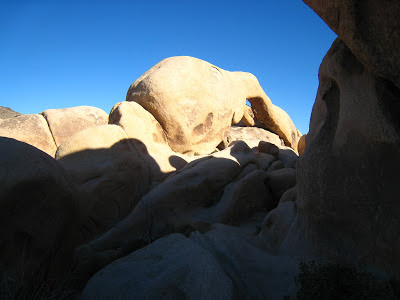
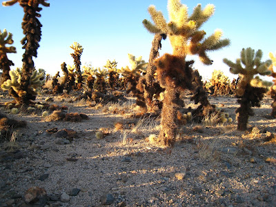
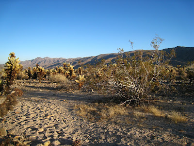
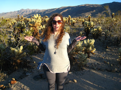
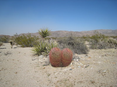
Then on to sunset at the Cholla Cactus Garden, which was something I had been looking forward to. Thanks again to earthquakes, in a basin within the transition zone between the Mojave (high/north) and Colorado (low/south) deserts, lies a large collection of almost nothing but Cholla ("holla!" heh) as far as the eye can see. Chollas are an interesting looking cactus which are a mixture of white, greens, and browns and can get pretty tall. They really look so pretty against the setting sun so it was a neat sight and we took our time lazily following the meandering path.


Then on to sunset at the Cholla Cactus Garden, which was something I had been looking forward to. Thanks again to earthquakes, in a basin within the transition zone between the Mojave (high/north) and Colorado (low/south) deserts, lies a large collection of almost nothing but Cholla ("holla!" heh) as far as the eye can see. Chollas are an interesting looking cactus which are a mixture of white, greens, and browns and can get pretty tall. They really look so pretty against the setting sun so it was a neat sight and we took our time lazily following the meandering path.
Finally, we took in the last light of day at Mara Oasis nature trail. Native Americans called it mar ah which is land of water and trees or something similar and they used to settle there due to the water and these trees which would be used for foods and medicines and building materials. Earthquakes caused the grounds to shift and lose the water source so the Native Americans moved. Twilight on this walk was very pretty. Just us strolling hand-in-hand and reading the placards. Saw a baby bunny :)


The next morning, even though we were sleeping in, I woke up early. Like, barely light out early. Instantly I knew my plan: out to the porch to watch the birdfeeder! I filled that bad boy up and sprinkled some bread and veggies for the bunnies. Then, camera and nockies at the ready, curled under the blanket on the chaise to watch the morning unfold. What a lovely, lovely way to start the day. Just me and nature. This became my routine for most of the week.
Our plan that day, if you can call it that, was to head to the park, drive around a bit, and hit the Geology Tour. I'd been really excited for this because it seemed to be a great introduction to the park as it describes how the landscape came to be. Despite the gallons of water we kept in the back I should say here that today was to be about exploration from the car. So upon my insistence we dismantled the jeep's fabric top (like the old days when Chris had one) and hit the road!
There are many ways to enter JTNP whose perimeter is ovular, with Rock Haven (town of Joshua Tree) being about 10:00, Palm Springs and Palm Desert being about 6 and 7:00 and a lot of blank map at 3:00. See here for illustration: http://tinyurl.com/JTNP-Map. Most require you to enter through a manned hut where you buy a ticket or show your pass (we bought a weekly at this time). The map was easy to use and led us with no problems to the start of Gelology Tour. We took our time, reading everything in detail, studying the formations referenced in the descriptions, and taking pictures.
So it was nearly 4:30 by the time we wrapped up the last stop along the tour and the following conversation took place:
Him: Hey, there is 4x4 trail right around here, Berdoo Canyon, that might be fun.
Her (noticing the sun was already beginning to cast its yellow glow on the mountain ranges): Seems like it's getting late-why don't we do it tomorrow?
Him: It's only about 15 miles-we have plenty of time.
So off we go.
Now, as I said, Chris owned a jeep for years. And no, he didn't "go off-roading" often but I knew he knew the capabilities of a jeep so I felt comfortable in that regard. And things were fine for a while. Then he started semi-freaking out. Something about it being "a rental car" and "how small the tires" were. And we'd been fine thus far so at that juncture I played the role of the positive reassurer. But the further along the trail we went the bigger the boulders got and the tighter the canyon grew. And it was this "tighter the canyon grew" part, along with the setting sun that led me to abandon the role as the positive reassurer and take on the role of the cautious observer: "I can't see the sun over the mountains anymore..."
The beady headlights of our rental car with the small tires didn't do much in the way of assisting vision other than allow me to cautiously observe: "I see tire tracks this must be the right way!" It's funny what gives one peace in times of semi-freakout. I'd read that tracks, be them tire, foot, or animal, can lie untouched in the desert for literally years. Anyhoo, we pressed on. Chris's long and lean body now leaning out the side of the jeep to better see the boulder challenges ahead. I should say here that *this*, this 4x4 through an unmaintained, nighttime, drive-at-your-own-risk rocky road in the middle of the desert doesn't have to be scary. I can think of tens of scenarios where this would be excellent.
After my cautious observer role I took on the role of silent passenger. I was using the "even the worst case scenario isn't that bad" logic. Worst-case scenario I thought might be having to spend the night in the desert. That in and of itself didn't scare me. And wrong though I may have been I didn't think animals eating us would be an issue. Nor did I the think the cold would get us in the end. It was that this canyon was so tight and so steep it felt like it was closing in on us. I remember thinking or saying: it's amazing to me how, in the day so majestic, the same mountains are in the night so ominous.
After my cautious observer role I took on the role of silent passenger. I was using the "even the worst case scenario isn't that bad" logic. Worst-case scenario I thought might be having to spend the night in the desert. That in and of itself didn't scare me. And wrong though I may have been I didn't think animals eating us would be an issue. Nor did I the think the cold would get us in the end. It was that this canyon was so tight and so steep it felt like it was closing in on us. I remember thinking or saying: it's amazing to me how, in the day so majestic, the same mountains are in the night so ominous.
It's now 8pm. Neither have said a word in some time. The canyon begins to open up a bit. Chris checks the map. Tire tracks are leading in every direction. How can one get "lost" in a canyon? We can laugh about it now because no kidding at that exact moment we see headlights coming from out of the mountain range. A small pick-up truck. Chris jumps out and flags them down, "Hey man we're lost-which way out of the park?" Turns out wed make it to the large wash of end of the trail. Soon we are on a paved road and I am laughing at the fear that enveloped me mere moments before.
We had exited the park at around 6:00 on the map and decided to swing around the southern loop through Palm Desert and Palm Springs. Lo and behold we come across a Del Taco. Hello dinner!
We had exited the park at around 6:00 on the map and decided to swing around the southern loop through Palm Desert and Palm Springs. Lo and behold we come across a Del Taco. Hello dinner!
The next day Chris shined up the jeep inside and out, as he would do each morning thereafter, ridding it of the dust and debris we inevitably collected each day on our adventures.
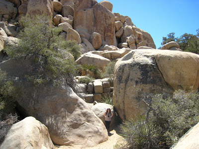
We began with a nature trail called Hidden Valley a rock-enclosed valley rumored to have been used by cattle rustlers.
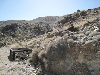
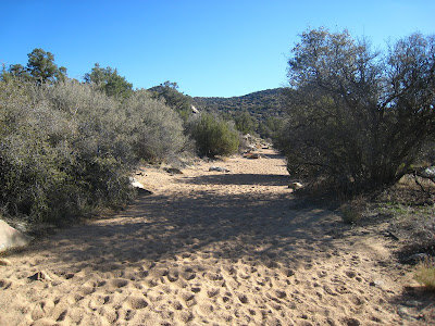
Then we tackled Contact Mine (the mine produced gold and silver in the early 1900s. Building ruins, old machinery, tram tracks, a cable winch, and partially collapsed shafts are still visible). We drove to the parking area where we had read the trail begins which isn't a parking area for the trail, rather, a parking area for the park information sign that sits along the side of the road. One other car was there. There is no trailhead for this hike and no real markers (I know what you're thinking) so you are relying on the words of others when they say things like "walk southeast toward the mountain range" and "spend two hours trudging through a wash." Ok so not really 2 hours exactly but it certainly seemed like it b/c walking through a wash is like walking through cookie dough.
It was hot hot hot this day and the sun was desert-strong which is what we had expected, being in the desert. The trail for the most part was marked with cairns from those who came before (and we added a few of our own along the way to help those who come after) but this didn't mean there weren't times when we we wondered if we were going the right way. Then I thought of what a dirty trick it would be to set up fake cairns. Guiding people knowingly in the wrong direction. And how bad and wrong and mean that would be. But I decided nature-lovers were unlikely to do that and reminded myself of this along the way. It was rocky and dry and reminded me of hiking through a quarry. "I feel like I'm on Mars," Chris said, and I laughed b/c I knew he was so right: http://ngm.nationalgeographic.com/2008/12/planet-mars/updike-text.
We were fascinated discussing how all this might have appeared during the mine's heyday. Even though it wasn't me that was interested in seeing the mine's remains the hike itself I thought was a fine one. It was the first time we realized how extremely vast this park is. Or seems, at least, when you look over the miles you just hiked and can't tell from which direction you came and a 360 spin yields exactly the same views. We pause for a moment taking in the peace and the refuge from the cacophony of everyday life. Here it was just quiet and wind....
We think we see something-break out the nockies: person in white tshirt near what we had earlier guessed (hoped) was part of the Contact Mine. Several switchbacks later we encounter White Tshirt and of course have a friendly hiker exchange. We talk about our experiences on the trail and we laugh to learn each other encountered similar feelings along the way (am I going in the right direction?). I notice his pack and conclude he is much better prepared than we. I ask Chris later what do you think he had in there? We imagine food, water, maps, guidebook, compass, blanket.
Shortly we arrive at the remnants of the mine. Typically a curious person I am amazed how uninterested in this I am as Chris takes his time inspecting rusty cans and other unidentifiable "mine debris" and requesting the obligatory photo op with the winch. We approach the shafts. He tosses a stone through the wire meshing into the dark hole and we listen to hear how far down it travels....it travels about a half a second and we laugh (obviously not the first ones to do the same).
We start to head back. The sun is just starting to go down. After a while I play out in my mind's eye how the rangers would find our camera near our bodies and use the pictures wed earlier taken to trace our path, saddly shaking their heads as they announce on the 6:00 news wed been only a few hundred feet from the trailhead. Then once in a while Id take on that cautious observer role: "Are we sure this is the way we came?" seconds later laughing as we round the bend and see the giant penis-like cactus sticking out of the mountain that wed laughed at on the way up.
The next day was 49 Palms Oasis which was a trail I chose b/c who doesn't want a chance to see water in the desert? We got an early start and arrived at the trailhead just as the sun was coming up. Cool wind, warm sun, birdies abound-what an awesome way to start the day! This hike was nice-different terrain than the day before (if only in color) so that was cool.
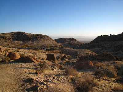
A ways in we began seeing the tippy tops of palm trees. They'd subsequently disappear and reappear until we came upon the rightly named oasis.

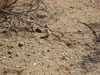

This cluster of tall regal lush (yes 49, at least-of course we counted) palms was in stark contrast to the desert dust we'd trekked through to reach it. We explored the area with a damp spot near the base of a tree being the closest thing we found to water.

We had snacks on a large shady cool rock then made our way to a large sunny warm one beyond the palms where time disappeared as we watched the grand leaves sway in the breeze and the birdies fly overhead in the cloudless blue sky.

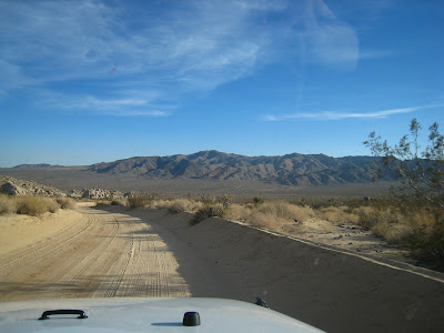
Next we headed to Black Eagle Road, another 4x4 trail. Welcomingly uneventful given our last off-road experience.
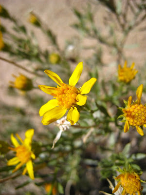
We put the finishing touches on our day with Cottonwood Springs-a nature hike and our second attempt at finding water in the desert! The spring was formed due to earthquake activity and the Native Americans used this area for generations, which you learn from reading the signs posted by the park. Even though we did not see water this ended up being hands-down the prettiest nature trail we did! And not just because it looked like the palm trees were wearing sweaters. All I could keep saying as we walked through was how much it looked like Land of the Lost! The old-timey one my older sister used to watch. But without the Sleestaks. And the man-eating dinosaurs. It was just so so pretty-the mountains surrounding us riddled with tufts of various textures and shades of greens and browns, pathways lined by patches of new spring flowers, and of course the golden yellow light of the setting sun which Im convinced can make anything look pretty.
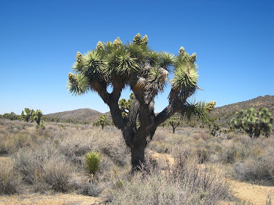
The next day we hiked my pick: Covington Flats Loop. I was really really excited about this hike b/c it was described as a large concentration of Joshua (allegedly the tallest), Juniper, and Pine trees. The start of the hike is sad as you see the burn damage of mother nature's fire (lightning strikes). An occassional Joshua tree stretches its blackened branches upward but most lay sooty and broken and defeated on the desert floor. Eventually though you do reach areas that havent been destroyed and they are beautiful. I cant even tell you-it was like walking through a fairytale book. Joshua trees as far as the eye could see-standing like an army of dependable soldiers through day and night, through wind and calm. Spinning round and round, trying like mad to soak in every detail of "amazing" surrounding us...I always believed I had to travel far and wide to be so moved. I had no idea something in the United States could take my breath away.
The path is clearly marked if you stay on the loop. We did not. We chose the road less traveled which was a combination of trails wed read about online. After a few hours into the hike and we encounter the park information sign (where we were to separate from the clearly marked loop trail), where we spend about 20 minutes with map in hand 360-ing in the desert sand leaving a ring of footprints clearly saying "I'm lost," we head out! And eventually we head back. We were supposed to encounter a wash and did not. Returning to the sign we took what really was the only other thing that could be considered a wash. We hadnt thought it was at first though b/c it was so narrow and unassuming-and coming off the heels of the Contact Mine wash (large) it threw us off a bit.


So along we go-still not completely sure we are going the right way but still really enjoying the hike and, like most of the week, not encountering another single soul. The mountains begin to converge and we eventually reach a canyon packed with branches and boulders. Is this right? While we occasionally do see footsteps (in all directions) the "path" by this point has long since disappeared. The setting sun is now hidden by the canyon walls and the familiar transition of "beauty" to "scary" has begun to take place. The canyon opens up and we feel good. Then it begins to narrow again and we dont feel good.


So along we go-still not completely sure we are going the right way but still really enjoying the hike and, like most of the week, not encountering another single soul. The mountains begin to converge and we eventually reach a canyon packed with branches and boulders. Is this right? While we occasionally do see footsteps (in all directions) the "path" by this point has long since disappeared. The setting sun is now hidden by the canyon walls and the familiar transition of "beauty" to "scary" has begun to take place. The canyon opens up and we feel good. Then it begins to narrow again and we dont feel good.
.JPG)
We push on and by now are considering whether to turn back. There is enough daylight we think we could jog back to the park sign and even follow our footsteps all the way back to the trailhead. But we need to decide soon...one way or the other. And this becomes more pressing when we come upon what I can only describe as the bones of an old waterfall. Monsterous boulders seriously the size of cars that represent a "no turning back point" b/c once we climb down we cant climb back up. We decide to push on. I wish I had taken pictures of this and was actually surprised to realize I hadnt but i guess i was too busy fighting for my life. The canyon again opens. We are to follow the wash until it intersects with the path we initially traversed. Which I guess will be identifiable by......?
We round a bend. Suddenly from Chris, "What the fuck," picking up the largest from a row of rocks lining an intersecting path. Then I see: a pack of dogs coming from our left. We stand still and silent. They trot on, barely paying us attention. I once again thank those that have come before us for helping to identify the path we are to rejoin and lay a rock of my own in homage. Chris encourages me by pointing out the unmistakable footprints my Keens, walking towards us now, made hours earlier that day, further solidifying we were headed the right way. How did you know those were my footprints!? I ask, assuming it was a tip hed learned in Eagle Scouts as a boy. Because Ive been looking at them...and your butt (gives devilish grin) all week as Ive hiked behind you.
We return safely to the trail head to, as always, the only car in the lot. A bit of sunlight remains and we check the map to see how we can finish off our day. Eureka Peak. I dig sunsets just like PonyBoy. Driving up a single lane tightly wound dirt mountain road flanked by steep drop offs (me laughing uncontrollably as Chris honks around each turn) we reach the peak and it is awesome. It felt like we were the only people on earth. Arm in arm, wind whipping around us, watching that sunset....

Time for another hike to a mine (fake cheer): Lost Horse. We pull up to the trailhead and see what we haven't seen all week-other people. We pull up behind another car in what appears to be the only remaining space for us to park and have no choice but to notice, as we begin gathering our odds and ends for the hike, the older couple enjoying what seems like grapes, wine, and massive baguettes in the back of their minivan. What happens next I believe happened without words. We look at a trail entrance on the other side of the parking lot, look an another trail entrance right next to our jeep, and take the latter. This trail can either be a loop, along which one encounters the mine (which is *not* the midway point) and continues on, or it can be a shorter one-way in, same-way out if you just want to hike to the mine then turn around and return. We had chosen option B.
Funny thing about this hike-it was rated easier than all the others we'd done, yet, it was by far the most difficult. Not that the other hikes were particularly difficult b/c they weren't (not once had either of us had to stop to rest) but in comparison with the others this one hands down seemed harder (out of breath-so elevation, perhaps) and way way way longer (more on that later).
Hiking hiking hiking...where's the mine? We knew the hike was only a couple of miles in and a couple of miles out yet when we looked at the time we were able to calculate we'd been hiking way more than 2 miles. And given all the cars in the parking lot...where the heck was everybody? The views along the way were spectacular and we stopped often to just take them in. In particular the majestic snow-capped Mts San Jacinto and Gorgonio standing in the distance. Also interesting along the way were what appeared to be various other mining areas (is this it? this cant be it...) and a seating area around a large stone fireplace. Note that when you get to the large stone fireplace you are not almost there. Sorry. But you *are* almost there when you get to the "throne" on the right of the path. Its back is to you but there is no mistaking it when you reach it. I imagine on a warmer windless day this would be the perfect place to chill for a bit. From the throne you have one more steep ascent then another turn around a mountain, then you will see the mine.
Oddly (or at least was at the time), people were at the mine when we arrived. There is more to see at LHM than at CM so we spent a bit of time here exploring. Eventually another couple arrive-its Baguette. They poke around for a short bit then begin to argue which direction to take back to the parking lot. They had come the same direction we had and were fighting about which was the better way to head back: a) same-in-same-out or b) finish the loop. They concluded what Chris and I knew from the outset: it was shorter to same-in/same-out. It was miles longer to complete the loop if you continued on. It was still cold and windy when we hit the trail to return. We paid even closer attention to the amount of time spent and the amount of ground covered and were certain something was amiss. Turns out we had taken the end of the loop to the mine rather than the start of the loop to the mine. I guess the start of the shorter trail to the loop was not the one by our jeep. So what should have been two miles each way was four. And what should have been four miles roundtrip was eight. User error. Live and learn.
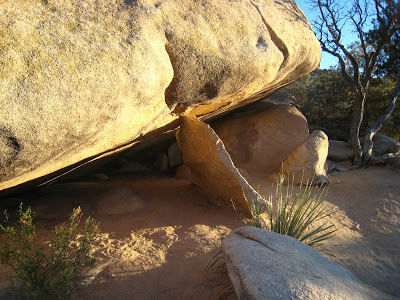
We had time to squeeze in a last nature trail-which happened to also be our third and final attempt to see water in the desert: Barkers Dam. We are 0 for 2 now. We make a bet-I say we will see water (eternal optimist) and he says he won't (eternal pessimist). Hopping out of our dusty jeep we met a friendly older couple armed with some impressive looking cameras and a grand standard poodle who had planned to join them along the trail...until the sign no dogs allowed (snoopy). Chris and I darted ahead jumping from boulder to boulder and racing each other along the path like kids. I remember thinking it looked like we were in Jerusalem. We approach the dam and.....!!!! I lose. No water. Walking back we again encounter the snoopy-less couple pausing to take pictures of something nestled in the mountainside. They can't resist showing it to us and we end the day and our time in JTNP with a good laugh as we all study what looks like a tiny sliver of rock holding up a giant boulder.
We drove towards the park exit in silence as the sun laid its warm golden blanket on all that surrounded us. Pulling over to take what I always promised was "one last picture" and trying like mad to commit every Joshua Tree, every flower, every detail to memory I said, "I could seriously stay here forever" and was surprised at the response, "I know, me too."



.jpg)
